How does Sentinel-2 protect India’s biodiversity?
India is a country with rich biodiversity, with a wide range of ecosystems, including forests, grasslands, and wetlands. However, the country’s biodiversity is facing numerous threats, including climate change, habitat destruction, and pollution. To mitigate these threats, scientists at the Indian Space Research Organisation (ISRO), Indian Institute of Space Science and Technology (IIST), and Gujarat University have developed a new satellite mapping system, Sentinel-2. This innovative technology has the potential to revolutionize the way we monitor and protect India’s biodiversity, particularly in its wetlands.
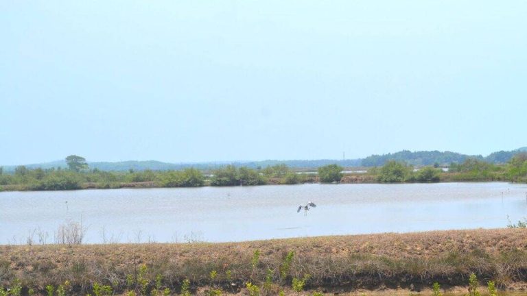
Wetlands are one of the most important ecosystems in India, providing habitat for a wide range of plant and animal species. They also play a crucial role in maintaining water quality, preventing floods, and supporting agriculture. However, India’s wetlands are facing numerous threats, including encroachment, pollution, and climate change. To address these challenges, the Sentinel-2 satellite mapping system was developed to monitor the health of India’s wetlands.
The Sentinel-2 system uses advanced satellite imagery to identify and map submerged plants in India’s wetlands. The system has been shown to be highly accurate, with a 94% success rate in identifying submerged plants. This is a significant improvement over traditional methods of monitoring wetland health, which can be time-consuming and labor-intensive. The Sentinel-2 system has been used to monitor 500 of India’s largest wetlands, providing valuable insights into the health of these ecosystems.
The results of the study are alarming, with nearly 100 lakes, mostly in central and southern India, showing a major decline in vital plant life. This decline is likely due to a combination of factors, including climate change, pollution, and encroachment. The study highlights the urgent need for climate action to protect India’s wetlands and the biodiversity they support.
The Sentinel-2 system has the potential to play a critical role in protecting India’s biodiversity. By providing accurate and up-to-date information on the health of India’s wetlands, the system can help policymakers and conservationists to develop effective strategies for protecting these ecosystems. The system can also be used to monitor the impact of conservation efforts, allowing for more effective management of India’s wetlands.
The development of the Sentinel-2 system is a significant achievement for Indian scientists, who have been at the forefront of efforts to protect the country’s biodiversity. The system is a testament to the power of innovation and technology in addressing environmental challenges. By leveraging advanced satellite imagery and machine learning algorithms, the Sentinel-2 system is able to provide insights into the health of India’s wetlands that would be impossible to obtain through traditional methods.
The use of satellite imagery to monitor wetland health is not new, but the Sentinel-2 system represents a significant advance in this field. The system’s high accuracy and ability to identify submerged plants make it a powerful tool for conservationists and policymakers. The system can also be used to monitor other aspects of wetland health, including water quality and soil moisture.
The decline of plant life in India’s wetlands has significant implications for the country’s biodiversity. Wetlands provide habitat for a wide range of plant and animal species, and the loss of these ecosystems can have far-reaching consequences for the health of India’s ecosystems. The decline of plant life in wetlands can also have significant impacts on human communities, who rely on these ecosystems for food, water, and other essential resources.
To address the decline of plant life in India’s wetlands, urgent climate action is needed. This includes reducing greenhouse gas emissions, protecting and restoring wetlands, and promoting sustainable land use practices. The Sentinel-2 system can play a critical role in these efforts, by providing accurate and up-to-date information on the health of India’s wetlands.
In conclusion, the Sentinel-2 satellite mapping system is a powerful tool for protecting India’s biodiversity. By providing accurate and up-to-date information on the health of India’s wetlands, the system can help policymakers and conservationists to develop effective strategies for protecting these ecosystems. The system’s high accuracy and ability to identify submerged plants make it a significant advance in the field of wetland monitoring. The decline of plant life in India’s wetlands is a pressing concern, and urgent climate action is needed to address this issue. The Sentinel-2 system is an important step in this direction, and its development is a testament to the power of innovation and technology in addressing environmental challenges.
The study’s findings highlight the need for continued investment in the development and deployment of technologies like Sentinel-2. By leveraging advanced satellite imagery and machine learning algorithms, scientists can gain valuable insights into the health of India’s ecosystems, and develop effective strategies for protecting them. The Sentinel-2 system is an important tool in the fight against climate change, and its development is a significant achievement for Indian scientists.
In the coming years, the Sentinel-2 system is likely to play an increasingly important role in protecting India’s biodiversity. As the system continues to evolve and improve, it is likely to provide even more accurate and detailed information on the health of India’s wetlands. This information will be critical in developing effective strategies for protecting these ecosystems, and for promoting sustainable development in India.
News Source: https://researchmatters.in/news/satellite-monitoring-reveals-declining-plant-life-hundreds-indian-wetlands