NISAR Satellite Completes Tests, Ready to Beam Scientific Data
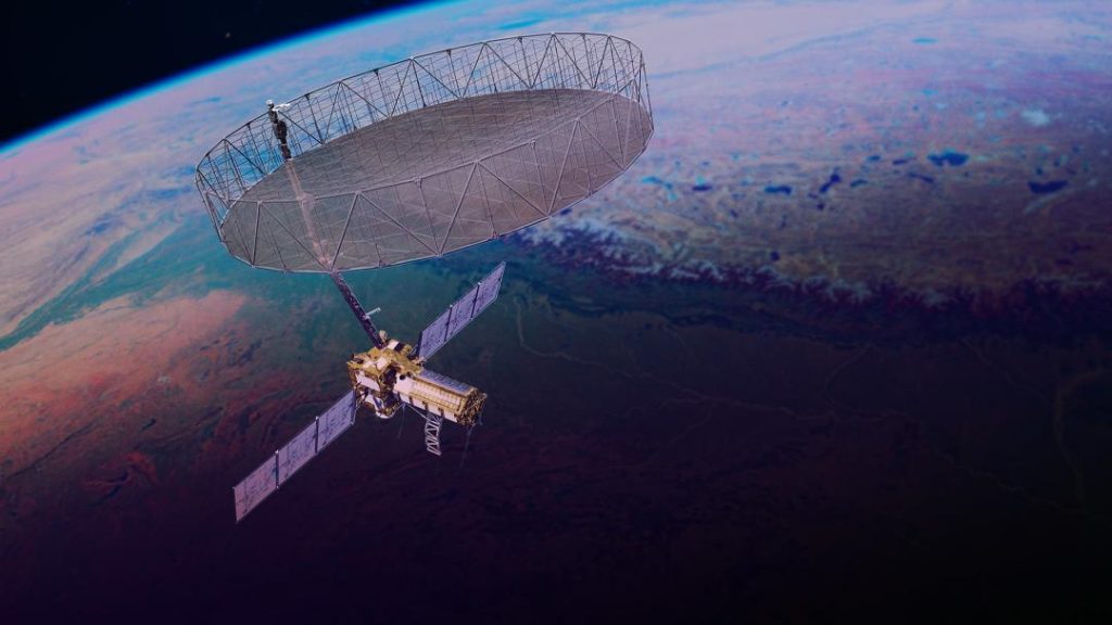
The NASA-ISRO Synthetic Aperture Radar (NISAR) Earth-observing satellite has completed its orbital tests and is now set to beam scientific data to ground stations. After launching on July 30, the NISAR, a joint effort between the National Aeronautics and Space Administration (NASA) and the Indian Space Research Organisation (ISRO), is on schedule to start science operations this fall.
NISAR is a highly advanced satellite designed to study the Earth’s surface by using a technology called Synthetic Aperture Radar (SAR). SAR is a powerful tool that allows the satellite to capture high-resolution images of the Earth’s surface, even in cloudy or foggy conditions, which is not possible with traditional optical cameras. This technology will enable scientists to study the Earth’s surface in a way that was not possible before.
The NISAR satellite is equipped with a advanced radar system that uses a combination of L-band and S-band radar frequencies to capture images of the Earth’s surface. The radar system is capable of capturing images with a resolution of up to 3 meters, which is much higher than any other SAR satellite currently in operation.
The primary goal of the NISAR mission is to study the Earth’s surface in order to better understand the effects of climate change, land degradation, and natural disasters. The satellite will be used to monitor the movement of glaciers, track changes in land use and land cover, and study the impact of natural disasters such as earthquakes and hurricanes on the environment.
One of the key features of the NISAR satellite is its ability to capture images of the Earth’s surface at different times of day and in different weather conditions. This will allow scientists to study the Earth’s surface in a way that was not possible before, and will provide valuable insights into the complex interactions between the Earth’s surface and the atmosphere.
The NISAR satellite will also be used to study the Earth’s biosphere, including forests, wetlands, and agricultural areas. The satellite will be able to capture images of these areas at different times of year, allowing scientists to study the impact of climate change on these ecosystems.
The NISAR mission is a joint effort between NASA and ISRO, and is a testament to the strong partnership between the two space agencies. The NISAR satellite is being built at NASA’s Jet Propulsion Laboratory in Pasadena, California, while the Indian Space Research Organisation is providing the satellite’s radar system and other components.
The NISAR satellite is scheduled to start science operations this fall, and will provide scientists with a wealth of new data and insights into the Earth’s surface. The satellite will be used to study a wide range of topics, including climate change, land degradation, and natural disasters.
In conclusion, the NISAR satellite is a highly advanced Earth-observing satellite that is set to beam scientific data to ground stations after completing its orbital tests. The satellite is a joint effort between NASA and ISRO, and is a testament to the strong partnership between the two space agencies. The NISAR satellite will provide scientists with a wealth of new data and insights into the Earth’s surface, and will be used to study a wide range of topics, including climate change, land degradation, and natural disasters.


