New Tech Maps Hidden Layers under Deccan Traps, Finds Gas Clues
The Deccan Traps, a vast region of volcanic rock in western India, has long been a mystery to geologists. For centuries, scientists have struggled to map the hidden layers beneath the thick volcanic rock, which has been a major obstacle in understanding the region’s geological history. However, a recent breakthrough in technology has made it possible to peer through the thick rock and uncover the secrets beneath.
Researchers from the Indian Institute of Technology (IIT) Bombay, along with their international collaborators, have developed a new method using Magnetotellurics (MT) and an improved algorithm to map the unseen sediment layers beneath the Deccan Traps. The innovative approach has not only provided a more accurate picture of the region’s geological history but also revealed potential gas reservoirs.
The Challenge of Mapping Under Deccan Traps
The Deccan Traps, which cover an area of approximately 500,000 square kilometers, are one of the largest volcanic regions on Earth. The thick layer of volcanic rock, which is estimated to be around 65 million years old, has made it extremely challenging for scientists to map the underlying sediment layers. The rock is not only thick but also highly resistive to electrical currents, making it difficult to use traditional methods such as seismic surveys or electrical resistivity tomography (ERT) to map the subsurface.
The Magnetotellurics Approach
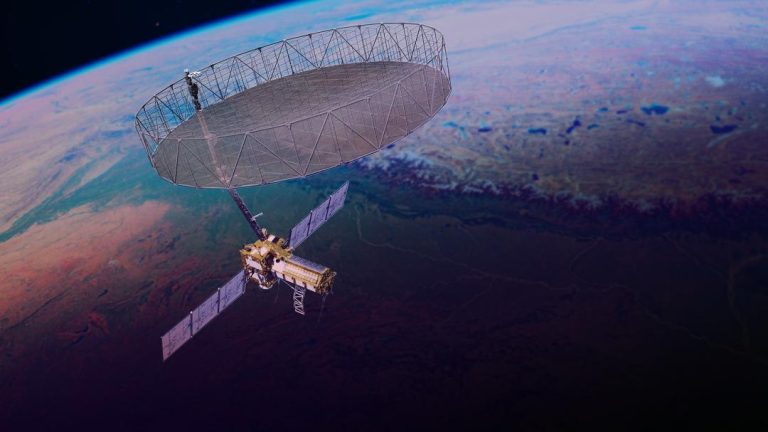
The research team used Magnetotellurics (MT), a geophysical method that measures the electrical and magnetic fields in the Earth’s subsurface. By combining the MT data with an improved algorithm, the team was able to create detailed images of the subsurface structure beneath the Deccan Traps.
The MT method works by sending electrical currents into the Earth and measuring the resulting magnetic fields. The strength and orientation of the magnetic fields provide information about the subsurface structure, including the presence of conductive or resistive layers. By analyzing the data, the researchers were able to create a detailed image of the subsurface, including the location and thickness of the sediment layers.
Improved Algorithm and Bayesian Analysis
To improve the accuracy of the MT data, the researchers developed an improved algorithm that combines the MT data with Bayesian analysis. Bayesian analysis is a statistical method that uses prior knowledge and observed data to update the probability of a hypothesis. In this case, the researchers used Bayesian analysis to combine the MT data with prior knowledge of the geological history of the region.
The improved algorithm enabled the researchers to create highly accurate and reliable images of the subsurface structure. The Bayesian analysis also allowed them to quantify the uncertainty associated with the images, which is essential for making informed decisions about exploration and resource development.
Results and Implications
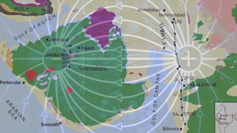
The research has provided a detailed image of the subsurface structure beneath the Deccan Traps, revealing several new features that were previously unknown. The images show that the region is characterized by a complex network of sediment layers, including potential gas reservoirs.
The discovery of potential gas reservoirs has significant implications for the region’s energy sector. The Deccan Traps are known to be rich in fossil fuels, and the new findings could lead to the discovery of new gas fields. The improved understanding of the subsurface structure also has implications for the region’s environmental management, as it provides valuable information about the potential risks associated with underground gas storage and extraction.
Conclusion
The recent breakthrough in technology has opened up new possibilities for mapping the hidden layers beneath the Deccan Traps. The combination of Magnetotellurics and an improved algorithm has provided a more accurate and reliable image of the subsurface structure, revealing potential gas reservoirs and shedding new light on the region’s geological history.
The research has significant implications for the region’s energy sector and environmental management. The improved understanding of the subsurface structure also has the potential to deepen our understanding of Earth’s hidden crustal mysteries.
Source: