How does Sentinel-2 protect India’s biodiversity?
In a groundbreaking achievement, scientists at the Indian Space Research Organisation (ISRO), Indian Institute of Space Science and Technology (IIST), and Gujarat University have developed a cutting-edge satellite mapping system, known as Sentinel-2. This innovative technology has the capability to identify submerged plants with an impressive accuracy of 94%. The study, which monitored 500 of India’s largest wetlands, has revealed alarming results, highlighting the urgent need for climate action. The findings indicate that nearly 100 lakes, predominantly in central and southern India, are experiencing a significant decline in vital plant life.
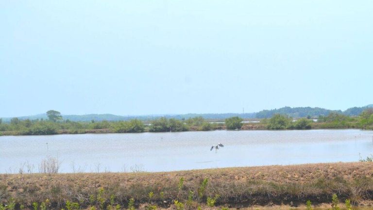
Wetlands are among the most crucial ecosystems in India, providing a habitat for a diverse range of flora and fauna. These ecosystems play a vital role in maintaining the country’s biodiversity, supporting agriculture, and regulating the water cycle. However, human activities such as deforestation, pollution, and climate change have led to the degradation of these sensitive ecosystems. The Sentinel-2 satellite mapping system has been instrumental in monitoring the health of India’s wetlands, providing valuable insights into the impact of human activities on these ecosystems.
The study, which utilized the Sentinel-2 satellite, employed a novel approach to identify and monitor submerged plants in India’s wetlands. The satellite’s high-resolution imaging capabilities allowed researchers to detect even slight changes in plant life, enabling them to assess the overall health of the ecosystems. The results of the study are a clarion call for urgent climate action, as the decline in plant life in India’s wetlands has severe implications for the country’s biodiversity and ecosystem services.
The Sentinel-2 satellite mapping system has several advantages over traditional methods of monitoring wetlands. Firstly, it provides high-resolution images, allowing researchers to identify even small changes in plant life. Secondly, it enables the monitoring of large areas, making it an efficient tool for assessing the health of India’s vast wetland network. Finally, the satellite’s frequent revisits to the same location allow researchers to track changes in plant life over time, providing valuable insights into the dynamics of these ecosystems.
The study’s findings have significant implications for India’s biodiversity. The decline in plant life in the country’s wetlands can have a ripple effect throughout the ecosystem, impacting the entire food chain. For example, a decrease in plant life can lead to a decline in the population of herbivores, which in turn can affect the population of carnivores. Furthermore, the loss of plant life can also impact the water quality, leading to an increase in pollution and decreased water availability for human consumption and agriculture.
The Sentinel-2 satellite mapping system has also highlighted the importance of conservation efforts in protecting India’s wetlands. The study’s findings demonstrate that human activities such as deforestation, pollution, and climate change are having a devastating impact on these ecosystems. To mitigate these effects, it is essential to implement effective conservation strategies, such as the restoration of degraded wetlands, the protection of catchment areas, and the promotion of sustainable land-use practices.
In conclusion, the Sentinel-2 satellite mapping system has been instrumental in monitoring the health of India’s wetlands, providing valuable insights into the impact of human activities on these ecosystems. The study’s findings are a stark reminder of the urgent need for climate action, and the importance of conservation efforts in protecting the country’s biodiversity. As India continues to grapple with the challenges of climate change, the Sentinel-2 satellite mapping system will play a vital role in monitoring the health of the country’s ecosystems, providing policymakers with the data they need to make informed decisions about conservation and sustainability.
The development of the Sentinel-2 satellite mapping system is a testament to the power of collaboration between scientists, researchers, and policymakers. By working together, we can develop innovative solutions to the complex challenges facing our planet, and create a more sustainable future for generations to come. As we move forward, it is essential that we continue to prioritize the conservation of India’s wetlands, and the protection of the country’s biodiversity.
In the face of climate change, it is more important than ever that we take action to protect our planet’s ecosystems. The Sentinel-2 satellite mapping system is a powerful tool in this effort, providing us with the data we need to make informed decisions about conservation and sustainability. As we continue to monitor the health of India’s wetlands, we must also work to address the root causes of their decline, and promote sustainable land-use practices that prioritize the protection of these vital ecosystems.
The study’s findings have also highlighted the need for increased awareness and education about the importance of wetlands and the impact of human activities on these ecosystems. By raising awareness about the importance of conservation, we can inspire individuals, communities, and organizations to take action, and work towards creating a more sustainable future for India’s wetlands.
In the end, the protection of India’s biodiversity is a collective responsibility, requiring the efforts of scientists, policymakers, and the general public. The Sentinel-2 satellite mapping system is a powerful tool in this effort, providing us with the data we need to make informed decisions about conservation and sustainability. As we move forward, it is essential that we continue to prioritize the protection of India’s wetlands, and work towards creating a more sustainable future for the country’s ecosystems.