How does Sentinel-2 protect India’s biodiversity?
India is a country known for its rich and diverse biodiversity, with a wide range of ecosystems, including forests, grasslands, and wetlands. These ecosystems are home to a vast array of plant and animal species, many of which are found nowhere else in the world. However, India’s biodiversity is facing numerous threats, including climate change, habitat destruction, and pollution. In recent years, scientists have been using satellite technology to monitor and protect India’s biodiversity, and one such initiative is the Sentinel-2 satellite mapping system.
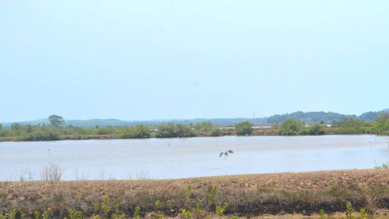
The Sentinel-2 satellite mapping system was developed by scientists at the Indian Space Research Organisation (ISRO), the Indian Institute of Space Science and Technology (IIST), and Gujarat University. This new technology uses satellite imagery to identify and monitor submerged plants in India’s wetlands, which are a crucial part of the country’s ecosystem. The study, which monitored 500 of India’s largest wetlands, found that the system can identify submerged plants with an accuracy of 94%. This is a significant breakthrough, as submerged plants are an important indicator of the health of a wetland ecosystem.
The study used data from the Sentinel-2 satellite, which is a high-resolution satellite that provides detailed images of the Earth’s surface. The satellite is equipped with a multispectral instrument that can detect a wide range of wavelengths, including visible, near-infrared, and short-wave infrared. This allows the satellite to collect data on the reflectance of different surfaces, including water, soil, and vegetation. The data collected by the satellite was then analyzed using machine learning algorithms, which were able to identify the presence of submerged plants with a high degree of accuracy.
The results of the study are alarming, with nearly 100 lakes, mostly in central and southern India, seeing a major decline in vital plant life. This decline is a result of a combination of factors, including climate change, pollution, and human activities such as agriculture and urbanization. The loss of submerged plants can have significant impacts on the ecosystem, including the loss of habitat for aquatic species and the reduction of water quality.
The decline of submerged plants in India’s wetlands is a serious concern, as these ecosystems provide a range of important ecosystem services, including water filtration, flood control, and carbon sequestration. Wetlands are also an important source of livelihood for many communities, providing fish, fuel, and other resources. The loss of these ecosystems can have significant social and economic impacts, particularly for marginalized communities that rely on them for their livelihood.
The Sentinel-2 satellite mapping system has significant implications for the conservation of India’s biodiversity. The system provides a cost-effective and efficient way to monitor and track changes in wetland ecosystems, allowing scientists and policymakers to take action to protect these areas. The system can also be used to identify areas that are most at risk, allowing for targeted conservation efforts.
In addition to the Sentinel-2 satellite mapping system, there are a range of other initiatives underway to protect India’s biodiversity. The Indian government has launched a number of programs aimed at conserving and restoring wetland ecosystems, including the National Wetland Conservation Programme. This program provides funding and technical support to states and local communities to conserve and manage wetlands.
Non-governmental organizations (NGOs) are also playing a critical role in protecting India’s biodiversity. Many NGOs are working with local communities to conserve and restore wetland ecosystems, and to promote sustainable livelihoods. These efforts are often focused on specific species or ecosystems, and can have significant impacts on the health of the ecosystem as a whole.
In conclusion, the Sentinel-2 satellite mapping system is a powerful tool for protecting India’s biodiversity. The system provides a cost-effective and efficient way to monitor and track changes in wetland ecosystems, allowing scientists and policymakers to take action to protect these areas. The results of the study, which found a significant decline in submerged plants in many of India’s wetlands, are a call to action for urgent climate action. It is imperative that we take steps to protect and conserve India’s biodiversity, including its wetland ecosystems, in order to ensure the long-term health and sustainability of these ecosystems.
The use of satellite technology, such as the Sentinel-2 satellite mapping system, is an important part of these efforts. By providing accurate and up-to-date information on the health of wetland ecosystems, these systems can help scientists and policymakers to make informed decisions about conservation and management. In addition, the use of satellite technology can help to raise awareness about the importance of wetland ecosystems and the need to protect them.
Overall, the Sentinel-2 satellite mapping system is an important initiative that has significant implications for the conservation of India’s biodiversity. The system provides a powerful tool for monitoring and tracking changes in wetland ecosystems, and can help to inform conservation and management efforts. As we move forward, it will be important to continue to develop and refine this technology, in order to ensure that we are doing everything we can to protect India’s rich and diverse biodiversity.
News Source: https://researchmatters.in/news/satellite-monitoring-reveals-declining-plant-life-hundreds-indian-wetlands