How does Sentinel-2 protect India’s biodiversity?
India is a country with rich and diverse biodiversity, with a wide range of ecosystems, including forests, grasslands, and wetlands. These ecosystems are home to a vast array of plant and animal species, many of which are found nowhere else in the world. However, India’s biodiversity is facing numerous threats, including climate change, habitat destruction, and pollution. To mitigate these threats, it is essential to monitor and manage India’s ecosystems effectively. Recently, scientists at the Indian Space Research Organisation (ISRO), the Indian Institute of Space Technology (IIST), and Gujarat University have developed a new satellite mapping system, Sentinel-2, which can identify submerged plants with 94% accuracy. This technology has the potential to revolutionize the way we monitor and manage India’s wetlands, which are a crucial part of the country’s biodiversity.
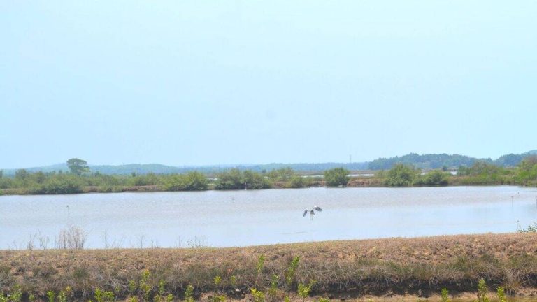
The importance of wetlands in India
Wetlands are ecosystems that are saturated with water, either permanently or seasonally. They can be found in a variety of forms, including lakes, rivers, marshes, and mangroves. Wetlands are essential for maintaining India’s biodiversity, as they provide habitat for a wide range of plant and animal species. They also play a crucial role in regulating the water cycle, preventing floods, and maintaining water quality. In addition, wetlands are important for human well-being, as they provide livelihoods for millions of people, including fishermen, farmers, and artisans.
The decline of plant life in Indian wetlands
Despite their importance, India’s wetlands are facing numerous threats, including climate change, pollution, and habitat destruction. A recent study using the Sentinel-2 satellite mapping system found that nearly 100 lakes, mostly in central and southern India, are experiencing a major decline in vital plant life. The study monitored 500 of India’s largest wetlands and found that many of them are losing their plant cover at an alarming rate. This decline in plant life has serious implications for the health of India’s wetlands, as plants play a crucial role in maintaining water quality, preventing erosion, and providing habitat for animals.
The Sentinel-2 satellite mapping system
The Sentinel-2 satellite mapping system is a powerful tool for monitoring India’s wetlands. Developed by scientists at ISRO, IIST, and Gujarat University, this system uses advanced satellite imagery to identify submerged plants with 94% accuracy. The system works by analyzing satellite images of wetlands and using machine learning algorithms to identify areas with plant cover. This information can then be used to monitor changes in plant life over time and to identify areas that are most at risk.
Applications of the Sentinel-2 satellite mapping system
The Sentinel-2 satellite mapping system has a wide range of applications for managing India’s wetlands. For example, it can be used to monitor water quality, as changes in plant life can indicate changes in water quality. It can also be used to identify areas that are most at risk of erosion or flooding, allowing for targeted conservation efforts. In addition, the system can be used to monitor the effectiveness of conservation efforts, such as the restoration of wetlands or the introduction of new plant species.
Urgent climate actions
The decline of plant life in Indian wetlands is a stark reminder of the urgent need for climate action. Climate change is having a profound impact on India’s ecosystems, from rising temperatures to changing precipitation patterns. To mitigate these impacts, it is essential to take immediate action to reduce greenhouse gas emissions and to protect and restore natural ecosystems. This can involve a range of strategies, from reducing pollution and habitat destruction to promoting sustainable land use practices and protecting biodiversity.
Conclusion
In conclusion, the Sentinel-2 satellite mapping system is a powerful tool for protecting India’s biodiversity. By monitoring changes in plant life, this system can help to identify areas that are most at risk and to target conservation efforts effectively. The decline of plant life in Indian wetlands is a serious concern, and urgent action is needed to address this issue. By using the Sentinel-2 satellite mapping system and taking immediate action to reduce the impacts of climate change, we can help to protect India’s precious biodiversity for future generations.