Chennai Researchers Develop Aerial Eye Tree Detection Algorithm
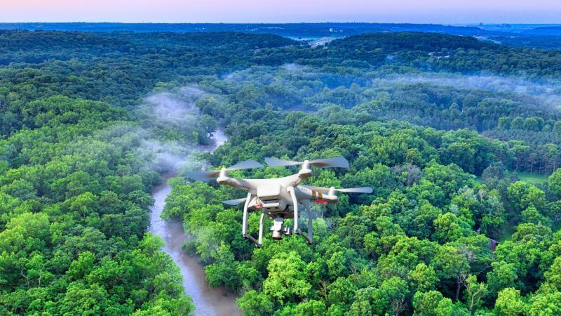
In a groundbreaking development, researchers at VIT Chennai have successfully created the Aerial Eye Tree Detection Algorithm (AETDA), a revolutionary system that leverages high-resolution drone imagery and the YOLOv8 deep learning model to automatically count and classify individual tree crowns with unprecedented accuracy. This innovative technology has the potential to transform the way we conduct tree surveys, providing a fast, accurate, and scalable alternative to traditional manual methods.
The AETDA system utilizes high-resolution images captured by drones to identify and classify tree crowns, specifically focusing on banana, oil palm, and coconut trees. By harnessing the power of the YOLOv8 deep learning model, the algorithm is able to achieve an overall accuracy of 0.722, as measured by the mean Average Precision (mAP50). This remarkable accuracy is a testament to the effectiveness of the AETDA system, which has far-reaching implications for various industries, including forestry, agriculture, and environmental conservation.
The Need for Accurate Tree Surveys
Tree surveys are a crucial aspect of forest management, urban planning, and environmental monitoring. Accurate tree counts and classification are essential for assessing forest health, monitoring tree growth, and identifying areas of conservation concern. However, traditional manual survey methods are often time-consuming, labor-intensive, and prone to human error. The use of drones and deep learning algorithms offers a game-changing solution to these challenges, enabling researchers and practitioners to collect and analyze data more efficiently and accurately.
How the AETDA System Works
The AETDA system consists of several key components, including:
- Drone Imagery: High-resolution images are captured using drones equipped with specialized cameras. These images provide a detailed and accurate representation of the tree canopy, allowing for the identification of individual tree crowns.
- YOLOv8 Deep Learning Model: The YOLOv8 model is a state-of-the-art deep learning algorithm that has been trained on a large dataset of images to recognize and classify objects. In this case, the model is fine-tuned to detect and classify tree crowns.
- Image Processing: The captured images are processed using specialized software to enhance quality, remove noise, and optimize them for analysis.
- Tree Detection and Classification: The processed images are then fed into the YOLOv8 model, which detects and classifies individual tree crowns based on their shape, size, and other characteristics.
Advantages of the AETDA System
The AETDA system offers several advantages over traditional manual survey methods, including:
- Speed and Efficiency: The system can process large areas quickly, reducing the time and effort required for tree surveys.
- Accuracy: The use of high-resolution drone imagery and deep learning algorithms ensures high accuracy in tree detection and classification.
- Scalability: The system can be easily scaled up or down depending on the size of the area to be surveyed.
- Cost-Effectiveness: The use of drones and deep learning algorithms reduces the need for manual labor, making the system more cost-effective.
Potential Applications
The AETDA system has a wide range of potential applications, including:
- Forestry Management: Accurate tree counts and classification can help foresters monitor forest health, identify areas of conservation concern, and develop effective management strategies.
- Agriculture: The system can be used to monitor crop health, detect pests and diseases, and optimize irrigation and fertilization strategies.
- Urban Planning: The AETDA system can help urban planners identify areas with high tree density, monitor tree growth, and develop strategies for urban forestry management.
- Environmental Conservation: The system can be used to monitor wildlife habitats, track changes in tree cover, and identify areas of high conservation value.
Conclusion
The development of the Aerial Eye Tree Detection Algorithm (AETDA) by researchers at VIT Chennai is a significant breakthrough in the field of tree surveys. By leveraging high-resolution drone imagery and the YOLOv8 deep learning model, the system provides a fast, accurate, and scalable alternative to traditional manual survey methods. With its potential applications in forestry, agriculture, urban planning, and environmental conservation, the AETDA system has the potential to transform the way we conduct tree surveys and manage our natural resources.
News Source: https://researchmatters.in/news/drones-and-deep-learning-join-forces-map-and-count-trees-accurately