Chennai Researchers Develop Aerial Eye Tree Detection Algorithm
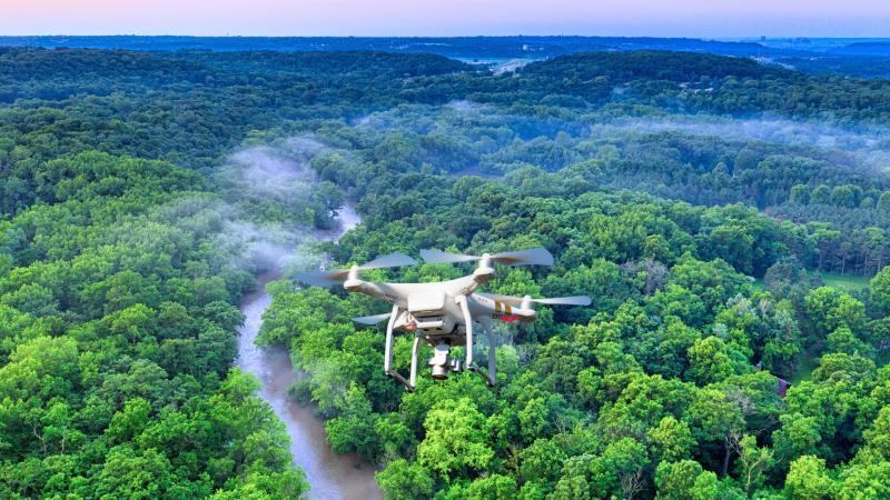
In a groundbreaking development, researchers at VIT Chennai have successfully created the Aerial Eye Tree Detection Algorithm (AETDA), a revolutionary system that leverages high-resolution drone imagery and advanced deep learning techniques to automatically count and classify individual tree crowns. This innovative approach has the potential to transform the field of forestry and environmental monitoring, providing a fast, accurate, and scalable alternative to traditional manual surveys.
The AETDA system utilizes the YOLOv8 deep learning model, a state-of-the-art object detection algorithm, to analyze high-resolution images captured by drones. The algorithm is specifically designed to identify and classify three types of tree crowns: banana, oil palm, and coconut. The researchers achieved an impressive overall accuracy of 0.722, measured by the mean average precision (mAP50), demonstrating the effectiveness of their approach.
The development of AETDA is a significant milestone in the field of environmental monitoring, where accurate tree counting and classification are crucial for various applications, including forest inventory, ecosystem management, and conservation efforts. Traditional methods of tree counting and classification often rely on manual surveys, which can be time-consuming, labor-intensive, and prone to human error. The AETDA system offers a game-changing solution, enabling researchers and practitioners to quickly and accurately assess tree populations over large areas.
The use of drones in forestry and environmental monitoring has gained significant attention in recent years, due to their ability to capture high-resolution imagery and navigate complex terrain. The integration of drone technology with deep learning algorithms like YOLOv8 has further enhanced the capabilities of these systems, enabling the automated analysis of large datasets and the detection of specific objects, such as tree crowns.
The AETDA system has several advantages over traditional methods. Firstly, it provides a fast and efficient way to collect data, reducing the time and effort required for manual surveys. Secondly, it offers high accuracy, minimizing the risk of human error and providing reliable results. Thirdly, it is scalable, allowing researchers to analyze large areas and track changes in tree populations over time.
The applications of AETDA are diverse and far-reaching. In forestry, the algorithm can be used to monitor tree growth, detect disease outbreaks, and optimize harvesting practices. In conservation, it can help track changes in tree populations, identify areas of high conservation value, and inform management decisions. In agriculture, it can be used to monitor crop health, detect pests and diseases, and optimize irrigation and fertilization practices.
The development of AETDA is also significant from a technological perspective, demonstrating the potential of deep learning algorithms to analyze complex datasets and detect specific objects. The use of YOLOv8, a state-of-the-art object detection algorithm, highlights the advancements in computer vision and machine learning, enabling the development of sophisticated systems like AETDA.
In conclusion, the Aerial Eye Tree Detection Algorithm developed by researchers at VIT Chennai is a groundbreaking innovation that has the potential to transform the field of forestry and environmental monitoring. By leveraging high-resolution drone imagery and advanced deep learning techniques, AETDA provides a fast, accurate, and scalable alternative to traditional manual surveys. The algorithm’s ability to automatically count and classify individual tree crowns with high accuracy demonstrates its potential for various applications, including forest inventory, ecosystem management, and conservation efforts.
As researchers and practitioners, it is essential to recognize the significance of this development and explore ways to integrate AETDA into existing workflows and systems. The potential benefits of this technology are substantial, and its adoption could lead to more efficient, effective, and sustainable management of forest ecosystems.
Source:
https://researchmatters.in/news/drones-and-deep-learning-join-forces-map-and-count-trees-accurately