10 Satellites Working to Ensure Citizens’ Safety: ISRO
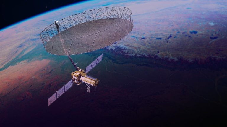
In the wake of heightened tensions between India and Pakistan, the Indian Space Research Organisation (ISRO) has been working tirelessly to ensure the safety and security of Indian citizens. According to ISRO chairman V Narayanan, 10 satellites are continuously working around the clock to monitor and secure the country’s borders.
Speaking to the media, Narayanan highlighted the crucial role that satellite and drone technology play in achieving national security. “We have to monitor our 7,000 km seashore areas. Without satellite and drone technology, we can’t achieve many things,” he emphasized.
The ISRO chief’s statement comes at a time when India is facing heightened tensions with its western neighbor, Pakistan. The two countries have had a history of conflict and have been engaged in a series of military standoffs in recent years. In such a volatile environment, the role of satellites in ensuring national security becomes even more critical.
ISRO has been at the forefront of developing and launching satellites that can provide critical data and surveillance capabilities to the Indian government. The organization has already launched several satellites in the past few years that have been used for a variety of purposes, including disaster management, weather forecasting, and surveillance.
The 10 satellites being referred to by Narayanan are likely to be a combination of operational and planned satellites that are being used for various purposes. Some of these satellites are likely to be part of ISRO’s existing fleet, while others may be new satellites that are being launched or planned for launch in the near future.
One of the key satellites that is scheduled to be launched by ISRO is the Cartosat-3, which is a high-resolution earth observation satellite that is expected to provide detailed images of the country’s borders and critical infrastructure. The satellite is scheduled to be launched on May 18, and is expected to provide critical data to the Indian government for various purposes, including national security.
In addition to the Cartosat-3, ISRO is also planning to launch other satellites in the near future that will be used for various purposes. These satellites include the RISAT-2BR1, which is a radar imaging satellite that will be used for surveillance and reconnaissance purposes, and the GSAT-30, which is a communication satellite that will be used for providing communication services to the country.
The role of satellites in ensuring national security is not limited to providing critical data and surveillance capabilities. Satellites can also be used to provide critical communication services to the military and other government agencies during times of crisis. For example, in the event of a war, satellites can be used to provide communication services to the military, which can be critical for coordinating military operations and maintaining situational awareness.
In addition to providing critical communication services, satellites can also be used to provide critical data and information to the government and military. For example, satellites can be used to provide real-time data on weather patterns, which can be critical for military operations and disaster response. Satellites can also be used to provide critical information on the movement of enemy troops and assets, which can be critical for national security.
In conclusion, the 10 satellites being worked on by ISRO are a critical component of the country’s national security infrastructure. These satellites will provide critical data and surveillance capabilities to the Indian government, which will be essential for ensuring the safety and security of Indian citizens. As the country continues to face threats from its western neighbor, the role of satellites in ensuring national security will become even more critical.
Source: