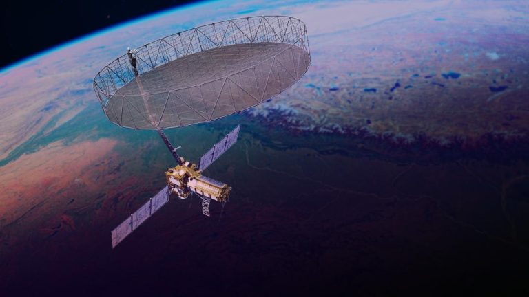
10 Satellites Working to Ensure Citizens’ Safety: ISRO
In the midst of heightened tensions between India and Pakistan, the Indian Space Research Organisation (ISRO) has been working tirelessly to ensure the safety and security of Indian citizens. According to ISRO Chairman V Narayanan, 10 satellites are continuously working around the clock to monitor and protect India’s borders and seashores.
In an interview, Narayanan emphasized the importance of satellite and drone technology in achieving this goal. “We have to monitor our 7,000 km seashore areas. Without satellite and drone technology, we can’t achieve many things,” he said. The ISRO chief’s statement highlights the critical role that space technology plays in maintaining national security and protecting the country’s citizens.
The 10 satellites in question are part of ISRO’s network of surveillance satellites, which are designed to provide real-time imagery and data to help monitor and respond to potential threats. These satellites are equipped with advanced sensors and cameras that can capture high-resolution images of the earth’s surface, allowing authorities to track and identify any suspicious activity.
ISRO’s surveillance satellites are also equipped with advanced sensors that can detect and track objects, such as ships and aircraft, that may pose a threat to national security. This technology has been proven to be highly effective in detecting and responding to threats, and has been used in a number of high-profile operations, including the recovery of the Indian Air Force’s Mig-27 aircraft that crashed in 2015.
In addition to its surveillance satellites, ISRO is also working on developing a network of drones that can be used to gather intelligence and monitor border areas. The use of drones is becoming increasingly popular in military and surveillance operations, as they offer a number of advantages over traditional aircraft. Drones are more maneuverable and can fly at much lower altitudes, allowing them to gather more detailed information about the target area.
ISRO is scheduled to launch another surveillance satellite on May 18, which will further enhance the country’s ability to monitor and respond to threats. The new satellite will be equipped with advanced sensors and cameras, and will be capable of providing high-resolution images of the earth’s surface.
The use of satellite and drone technology is not limited to military and surveillance operations. These technologies are also being used in a number of civilian applications, including disaster response and environmental monitoring. For example, ISRO’s satellites have been used to monitor and respond to natural disasters such as floods and earthquakes, and have provided critical information to emergency responders.
In conclusion, ISRO’s 10 surveillance satellites are playing a critical role in ensuring the safety and security of Indian citizens. These satellites are equipped with advanced sensors and cameras that allow them to monitor and respond to threats in real-time, and have been proven to be highly effective in detecting and responding to threats. The use of satellite and drone technology is becoming increasingly important in a number of civilian applications, and ISRO is at the forefront of this technology.