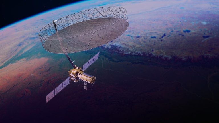
10 Satellites Working to Ensure Citizens’ Safety: ISRO
In the wake of escalating tensions between India and Pakistan, the Indian Space Research Organisation (ISRO) has been working tirelessly to ensure the safety and security of Indian citizens. According to ISRO chairman V Narayanan, 10 satellites are continuously working around the clock to monitor the country’s borders and seashores. This is a testament to ISRO’s commitment to using space technology for the benefit of the nation.
In an interview, Narayanan highlighted the importance of satellite technology in ensuring the security of Indian citizens. “We have to monitor our 7,000 km seashore areas. Without satellite and drone technology, we can’t achieve many things,” he said. This emphasis on the role of satellite technology in national security is a significant departure from the traditional focus on military might and terrestrial surveillance systems.
One of the key challenges that ISRO has been tackling is the monitoring of India’s long coastline. With a vast seashore stretching over 7,000 kilometers, it is a daunting task to ensure the security of these areas. Satellite technology plays a crucial role in this endeavor, providing high-resolution images and real-time data that can be used to detect any suspicious activity.
ISRO’s satellite fleet is equipped with advanced sensors and cameras that can capture images of the coastline in various weather conditions. These images can be used to identify any changes or anomalies in the coastline, which can be indicative of potential security threats. The satellites can also be used to monitor the movement of ships and vessels in the Indian Ocean, which is a critical component of the country’s maritime security.
In addition to monitoring the coastline, ISRO’s satellites are also used to monitor India’s borders with Pakistan. The organization has been using its satellites to detect any suspicious activity along the border, including the movement of troops and military equipment. This information can be used to inform military decisions and ensure the security of Indian citizens living in border areas.
ISRO’s satellite fleet is not limited to border surveillance and coastal monitoring. The organization’s satellites are also used for a range of other applications, including disaster response and management, weather forecasting, and communication services. In the event of a natural disaster, ISRO’s satellites can provide critical information to emergency responders, helping them to respond quickly and effectively.
ISRO’s commitment to using space technology for the benefit of the nation is evident in its plans to launch a new surveillance satellite on May 18. This satellite will join the existing fleet of 10 satellites that are currently working to ensure the safety and security of Indian citizens. The new satellite will be equipped with advanced sensors and cameras that will enable it to provide even more accurate and detailed images of the coastline and borders.
In conclusion, ISRO’s 10 satellites are playing a critical role in ensuring the safety and security of Indian citizens. From monitoring the coastline to detecting suspicious activity along the border, these satellites are providing valuable information that can be used to inform military decisions and ensure the security of the nation. As ISRO continues to expand its satellite fleet and capabilities, it is clear that space technology will play an increasingly important role in national security.