10 Satellites Working to Ensure Citizens’ Safety: ISRO
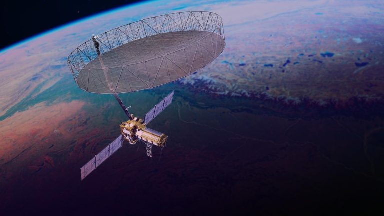
In the midst of heightened tensions between India and Pakistan, the Indian Space Research Organisation (ISRO) has been working tirelessly to ensure the safety and security of Indian citizens. According to ISRO chairman V Narayanan, 10 satellites are continuously working around the clock to monitor and protect Indian borders.
Speaking to the media, Narayanan emphasized the importance of satellite technology in securing India’s vast borders. “We have to monitor our 7,000 km seashore areas. Without satellite and drone technology, we can’t achieve many things,” he said. The ISRO chief stressed that the organization is committed to providing the Indian government with accurate and timely information to make informed decisions about national security.
The 10 satellites being referred to by Narayanan are part of India’s surveillance and monitoring system, which provides real-time data on various aspects of national security. These satellites are equipped with advanced sensors and cameras that enable them to capture high-resolution images of the Indian territory, including borders, coastlines, and urban areas.
One of the primary functions of these satellites is to monitor the Indian borders, which stretch over 15,000 km. This includes the 7,000 km coastline, which is vulnerable to threats from both land and sea. The satellites use advanced sensors and cameras to detect any unusual activity, including intrusions, smuggling, and drug trafficking.
The ISRO satellites also play a crucial role in monitoring India’s air and sea lanes. They are equipped with advanced radar systems that can detect and track aircraft, ships, and other vessels in real-time. This information is then used by the Indian government to make decisions about national security, including the deployment of military assets and the coordination of law enforcement agencies.
In addition to monitoring borders and surveillance, the ISRO satellites are also used for disaster management and response. They provide vital information to the Indian government during natural disasters such as earthquakes, floods, and cyclones. This information is used to coordinate rescue efforts, provide aid to affected areas, and reduce the impact of disasters on human populations.
ISRO is also planning to launch another surveillance satellite on May 18, which will further enhance the organization’s capabilities in monitoring national security. The new satellite will be equipped with advanced sensors and cameras that will provide even higher-resolution images of the Indian territory.
The launch of the new satellite is part of ISRO’s plans to expand its surveillance capabilities and improve its ability to respond to national security threats. The organization is also working on developing new technologies, including artificial intelligence and machine learning, to improve the accuracy and speed of its surveillance systems.
In conclusion, the 10 satellites being used by ISRO are a vital component of India’s national security infrastructure. They provide real-time data on various aspects of national security, including borders, air and sea lanes, and disaster management. The launch of the new surveillance satellite on May 18 will further enhance ISRO’s capabilities in this area and provide the Indian government with even more accurate and timely information to make informed decisions about national security.