How will Sentinel-6B satellite, launched from California, work?
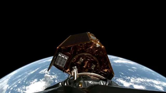
On a recent Monday, a significant milestone was achieved in the field of Earth observation with the launch of the Sentinel-6B satellite from a base in California. This satellite is designed to orbit the Earth at an incredible speed of 7.2 km/s, completing one full rotation every 112 minutes. The primary objective of the Sentinel-6B satellite is to monitor sea levels by measuring the height of the ocean surface. This critical information will play a vital role in enhancing weather forecasts, flood predictions, and ultimately, public safety and coastal infrastructure.
The Sentinel-6B satellite is an Earth-observing satellite that is part of the European Space Agency’s (ESA) Copernicus program, a series of Earth observation satellites designed to provide comprehensive and continuous data about the Earth’s environment. The satellite is equipped with advanced radar altimeters that will measure the height of the ocean surface with unprecedented accuracy. This data will be used to create detailed maps of the ocean’s surface topography, which will help scientists to better understand ocean currents, tides, and the effects of climate change on sea levels.
One of the primary benefits of the Sentinel-6B satellite is its ability to provide real-time data on sea levels. This information will be invaluable for meteorologists and scientists who rely on accurate sea level data to predict weather patterns and potential flood risks. By monitoring sea levels, the satellite will help to identify areas that are at risk of coastal erosion, flooding, and other hazards associated with rising sea levels. This information will enable authorities to take proactive measures to protect coastal communities and infrastructure, ultimately saving lives and reducing the economic impact of natural disasters.
The Sentinel-6B satellite will also play a crucial role in enhancing our understanding of the Earth’s climate system. By monitoring sea levels, the satellite will provide valuable insights into the effects of climate change on the world’s oceans. This information will help scientists to better understand the complex interactions between the ocean, atmosphere, and land, which will ultimately inform policies and strategies for mitigating the impacts of climate change.
In addition to its scientific applications, the Sentinel-6B satellite will also have significant practical benefits. For example, the satellite’s data will be used to improve navigation systems, particularly for ships and boats that rely on accurate sea level data to navigate safely. The satellite’s data will also be used to monitor ocean currents and tides, which will help to optimize maritime trade routes and reduce the risk of accidents at sea.
The launch of the Sentinel-6B satellite is a significant achievement for the ESA and its partners, including NASA, which has provided critical support for the mission. The satellite’s advanced technology and capabilities will provide unprecedented insights into the Earth’s ocean system, which will ultimately benefit humanity as a whole.
In conclusion, the Sentinel-6B satellite is a groundbreaking Earth-observing satellite that will play a vital role in monitoring sea levels and enhancing our understanding of the Earth’s climate system. With its advanced radar altimeters and real-time data capabilities, the satellite will provide invaluable information for scientists, meteorologists, and authorities responsible for protecting coastal communities and infrastructure. As we continue to face the challenges of climate change, the Sentinel-6B satellite will be an essential tool in our efforts to mitigate its impacts and create a more sustainable future for all.