Title: ₹13,000-crore ISRO-NASA NISAR satellite to scan entire Earth in 12 days
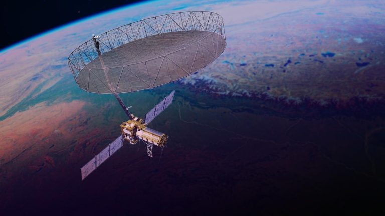
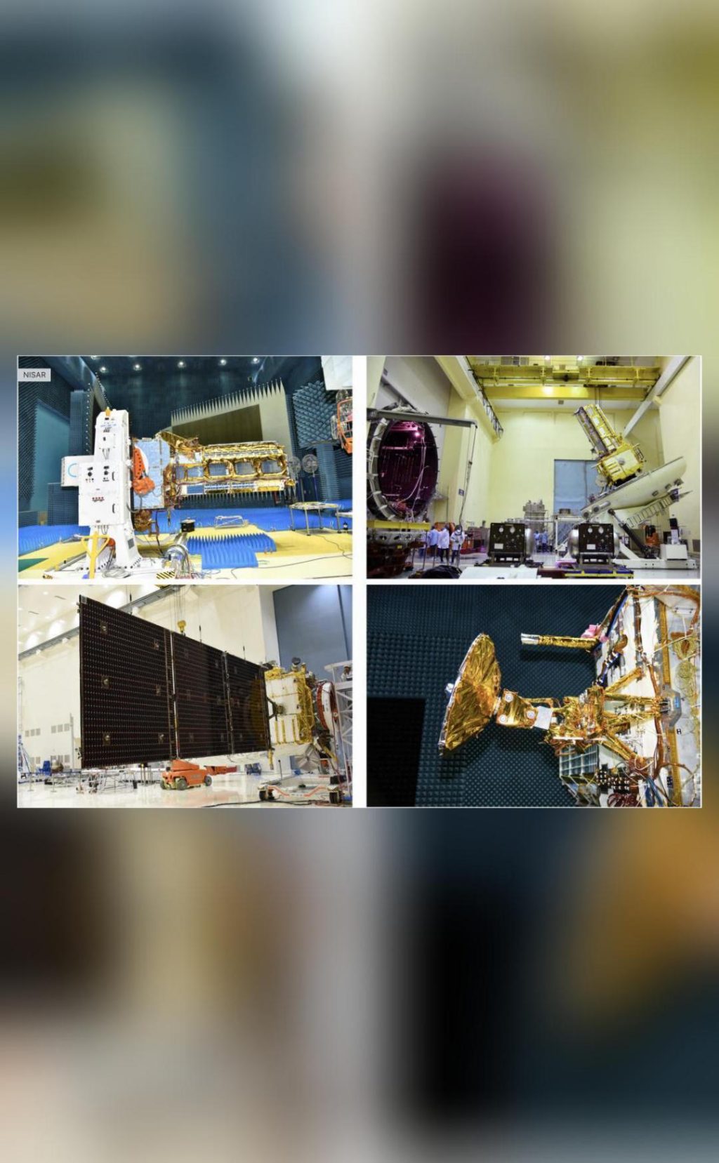
The Indian Space Research Organisation (ISRO) and NASA are all set to launch a revolutionary satellite, NISAR, which will capture high-resolution images of Earth’s surface every 12 days. This massive endeavour, worth ₹13,000 crores, will provide the most precise and detailed imaging of Earth ever attempted. The NISAR satellite, scheduled to be launched from Sriharikota, Andhra Pradesh, on July 30, will be the first in the world to operate simultaneously on two radar frequencies – NASA’s L-band and ISRO’s S-band.
The NISAR (NASA-ISRO Synthetic Aperture Radar) satellite is a joint project between ISRO and NASA, which aims to understand and monitor the Earth’s surface changes. The satellite will use advanced radar technology to capture images of the Earth’s surface, which will help scientists to study natural disasters such as earthquakes, tsunamis, and landslides. The satellite’s high-resolution images will also aid in monitoring urban development, tracking climate change, and understanding the impact of human activities on the environment.
One of the most impressive features of the NISAR satellite is its ability to scan the entire Earth in just 12 days. This is made possible by its unique radar technology, which allows it to capture images of the Earth’s surface from space. The satellite will be capable of capturing images of the same location with a resolution of up to 3 meters, which is much higher than any other satellite currently in operation.
The NISAR satellite will also be equipped with advanced sensors that will allow it to detect even the slightest changes in the Earth’s surface. This will enable scientists to study the impact of natural disasters such as earthquakes and tsunamis, and to develop more effective emergency response strategies. The satellite will also be used to monitor the movement of glaciers, monitor the health of forests, and track the spread of diseases.
The NISAR satellite is a significant achievement for both ISRO and NASA, as it marks the first time that the two space agencies have collaborated on a project of this magnitude. The satellite is the result of years of research and development, and it represents a major milestone in the field of space technology.
The launch of the NISAR satellite is scheduled to take place from Sriharikota, Andhra Pradesh, on July 30. The satellite will be launched using ISRO’s PSLV-C57 rocket, which will place it into orbit at an altitude of around 700 km above the Earth’s surface. After its launch, the NISAR satellite will begin its mission to scan the entire Earth in 12 days, providing scientists with a wealth of valuable data and insights.
The NISAR satellite is an important step forward in the field of space technology, and it represents a major achievement for both ISRO and NASA. The satellite’s ability to scan the entire Earth in 12 days will provide scientists with valuable data and insights, and will help to improve our understanding of the Earth’s surface changes. The satellite’s advanced radar technology will also enable scientists to study natural disasters and monitor the impact of human activities on the environment.
In conclusion, the ₹13,000-crore ISRO-NASA NISAR satellite is a significant achievement for both ISRO and NASA, and it represents a major milestone in the field of space technology. The satellite’s ability to scan the entire Earth in 12 days will provide scientists with valuable data and insights, and will help to improve our understanding of the Earth’s surface changes. The satellite’s advanced radar technology will also enable scientists to study natural disasters and monitor the impact of human activities on the environment.