10 Satellites Working to Ensure Citizens’ Safety: ISRO
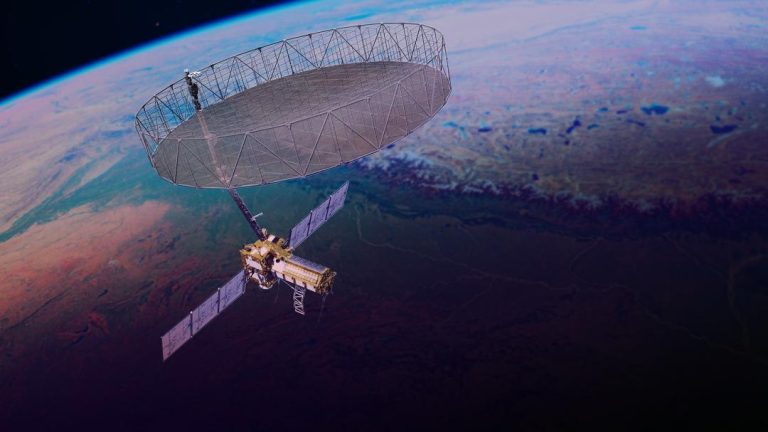
In the current scenario of heightened tensions between India and Pakistan, the Indian Space Research Organisation (ISRO) has taken a crucial step to ensure the safety and security of Indian citizens. According to ISRO Chairman V Narayanan, the organisation has 10 satellites working around the clock to monitor the country’s borders and protect its citizens.
“We have to monitor our 7,000 km seashore areas. Without satellite and drone technology, we can’t achieve many things,” Narayanan said in an interview. This statement highlights the importance of satellite technology in modern surveillance and monitoring systems. With the increasing threats to national security, ISRO’s efforts to harness the potential of satellites for surveillance and monitoring become even more crucial.
ISRO has been at the forefront of developing and launching satellites for various purposes, including remote sensing, communication, and navigation. The organisation has successfully launched several satellites in the past, including the Chandrayaan-1 mission to the moon and the Mars Orbiter Mission (Mangalyaan).
The 10 satellites working for national security are equipped with advanced sensors and cameras that enable them to capture high-resolution images of the country’s borders and coastal areas. These satellites are used to monitor activities along the borders, detect potential threats, and provide real-time data to the authorities.
One of the key advantages of satellite technology is its ability to provide a bird’s-eye view of the entire country. Satellites can cover vast areas, including remote and inaccessible regions, and provide detailed images of the terrain. This helps the authorities to identify potential threats and take proactive measures to prevent any incidents.
In addition to the 10 satellites already in operation, ISRO is scheduled to launch another surveillance satellite on May 18. This satellite will be equipped with advanced sensors and cameras that will enable it to capture high-resolution images of the country’s borders and coastal areas.
The role of ISRO in national security is multifaceted. The organisation’s satellites are used for a range of purposes, including:
- Border surveillance: ISRO’s satellites are used to monitor activities along the borders and detect potential threats.
- Coastal surveillance: The organisation’s satellites are used to monitor the country’s 7,000 km coastline and detect any suspicious activities.
- Disaster management: ISRO’s satellites are used to provide real-time data during natural disasters, such as floods and earthquakes.
- Navigation: ISRO’s satellites provide navigation data to the Indian Navy and other military agencies.
In conclusion, ISRO’s efforts to ensure national security through satellite technology are crucial in today’s fast-paced and increasingly complex world. The organisation’s 10 satellites working around the clock to monitor the country’s borders and coastal areas are a testament to its commitment to protecting the safety and security of Indian citizens.