10 Satellites Working to Ensure Citizens’ Safety: ISRO
In the face of heightened tensions between India and Pakistan, the Indian Space Research Organisation (ISRO) has been working tirelessly to ensure the safety and security of Indian citizens. ISRO Chairman V Narayanan recently revealed that 10 satellites are continuously working around the clock to monitor and protect India’s borders, coastal areas, and strategic assets.
The importance of satellite technology in ensuring national security cannot be overstated. With a coastline of over 7,000 kilometers, India’s maritime borders are a critical area of focus for the country’s security apparatus. The Indian Navy, Coast Guard, and other agencies rely heavily on satellite technology to monitor and respond to any potential threats.
In an interview, ISRO Chief Dr. K Sivan emphasized the crucial role of satellites in national security. “We have to monitor our 7,000 km seashore areas. Without satellite and drone technology, we can’t achieve many things,” he said. The ISRO chief’s statement underscores the significance of satellite technology in maintaining India’s security and sovereignty.
The 10 satellites working to ensure the safety and security of Indian citizens are equipped with advanced sensors and cameras that provide high-resolution images and data. These satellites are capable of monitoring the Indian Ocean, the Malacca Strait, and other critical areas of interest.
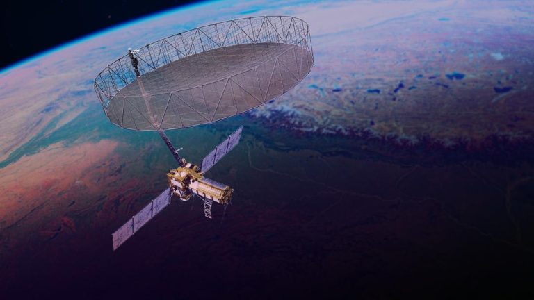
One of the key satellites in ISRO’s arsenal is the RISAT-2BR1, which was launched in February 2019. This satellite is equipped with advanced Synthetic Aperture Radar (SAR) technology that allows it to acquire high-resolution images of the Earth’s surface, even in the absence of sunlight. The RISAT-2BR1 has been used extensively to monitor India’s borders, detect and track enemy ships, and provide critical intelligence to the Indian military.
Another satellite that has been making headlines is the RISAT-2BR, which is scheduled to be launched on May 18. This satellite will further enhance India’s surveillance capabilities, providing high-resolution images and data to support military operations and national security.
ISRO’s satellite constellation is designed to provide continuous coverage of India’s borders and strategic assets. The satellites are equipped with advanced sensors and cameras that can detect and track enemy ships, aircraft, and other military assets. The data collected by these satellites is used to provide critical intelligence to the Indian military, allowing them to respond quickly and effectively to any potential threats.
In addition to its surveillance capabilities, ISRO’s satellite technology has also been used to support humanitarian efforts. For example, the ISRO’s Cartosat-2 series of satellites has been used to provide critical data and imagery to support disaster relief efforts in affected areas. The Cartosat-2 series has also been used to monitor the spread of natural disasters, such as floods and wildfires, allowing emergency responders to respond quickly and effectively.
ISRO’s commitment to national security is not limited to its satellite technology. The organization has also been working closely with the Indian military to develop and deploy advanced drone technology. The Indian Air Force (IAF) has already deployed a number of drones, including the indigenous Nishant and the Israeli-made Harop, to support military operations.
In conclusion, ISRO’s 10 satellites are working tirelessly to ensure the safety and security of Indian citizens. The organization’s satellite constellation is designed to provide continuous coverage of India’s borders and strategic assets, and its advanced sensors and cameras are capable of detecting and tracking enemy ships, aircraft, and other military assets. With the launch of the RISAT-2BR scheduled for May 18, ISRO’s surveillance capabilities are set to further enhance, providing critical intelligence to the Indian military and supporting national security efforts.