ISRO-NASA NISAR Mission to Launch in June 2025: A New Era in Earth Observation
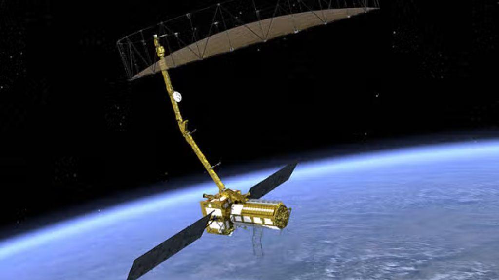
The highly anticipated NASA-ISRO Synthetic Aperture Radar (NISAR) mission is finally set to launch in June 2025, marking a significant milestone in Earth observation. After being delayed due to technical issues, the satellite is now fully assembled and ready for deployment at Sriharikota. This collaborative effort between the Indian Space Research Organisation (ISRO) and NASA will utilize dual-frequency radar to monitor climate change, natural disasters, and Earth surface changes with high-resolution imaging.
The NISAR mission is designed to provide critical data for disaster management, glacier tracking, and climate change monitoring. With its advanced radar technology, the satellite will be able to gather information on the Earth’s surface with unparalleled accuracy and precision. This data will be used to study the impact of climate change on glaciers, floods, landslides, and other natural disasters.
The NISAR mission will also focus on monitoring the Earth’s surface changes, including deforestation, land degradation, and urbanization. This information will be crucial for policymakers and researchers to develop effective strategies for sustainable development and environmental conservation.
The NISAR satellite is equipped with a unique dual-frequency radar system, which allows it to collect data in both L-band (1.25 GHz) and S-band (2.25 GHz). This capability enables the satellite to penetrate clouds and vegetation, providing high-resolution images of the Earth’s surface even in adverse weather conditions.
The L-band radar will be used to study the Earth’s surface with high accuracy, while the S-band radar will be used to monitor changes in the Earth’s surface over time. This dual-frequency radar system will provide a comprehensive understanding of the Earth’s surface dynamics and changes.
The NISAR mission is a significant collaborative effort between ISRO and NASA, reflecting the growing partnership between the two space agencies. The mission is a testament to the potential of international cooperation in advancing scientific research and development.
The NISAR satellite is expected to be launched into a sun-synchronous orbit at an altitude of approximately 500 kilometers. From this orbit, the satellite will be able to collect data on the entire Earth, covering the entire globe every 12 days.
The NISAR mission has significant implications for various fields, including:
- Climate Change Research: The NISAR mission will provide valuable data on the impact of climate change on glaciers, sea levels, and other natural systems.
- Disaster Management: The satellite’s high-resolution imaging capabilities will enable authorities to respond quickly and effectively to natural disasters such as floods, landslides, and earthquakes.
- Environmental Conservation: The NISAR mission will provide critical data for policymakers and researchers to develop effective strategies for sustainable development and environmental conservation.
- Urban Planning: The satellite’s high-resolution imaging capabilities will enable researchers to study urbanization and its impact on the environment.
The NISAR mission is a significant step forward in Earth observation, offering unparalleled capabilities for monitoring the Earth’s surface and changes. With its advanced radar technology and dual-frequency imaging capabilities, the NISAR satellite is poised to revolutionize our understanding of the Earth’s surface dynamics and changes.
Source:
https://www.itvoice.in/isro-nasa-nisar-mission-to-launch-in-june-2025-a-new-era-in-earth-observation