How does Sentinel-2 protect India’s biodiversity?
India, a country with rich and diverse biodiversity, is home to a wide range of ecosystems, including wetlands, forests, and grasslands. These ecosystems support a vast array of plant and animal species, many of which are found nowhere else in the world. However, India’s biodiversity is facing numerous threats, including climate change, habitat destruction, and pollution. To combat these threats, scientists at the Indian Space Research Organisation (ISRO), Indian Institute of Space Technology (IIST), and Gujarat University have developed a new satellite mapping system, Sentinel-2, which can identify submerged plants with 94% accuracy.
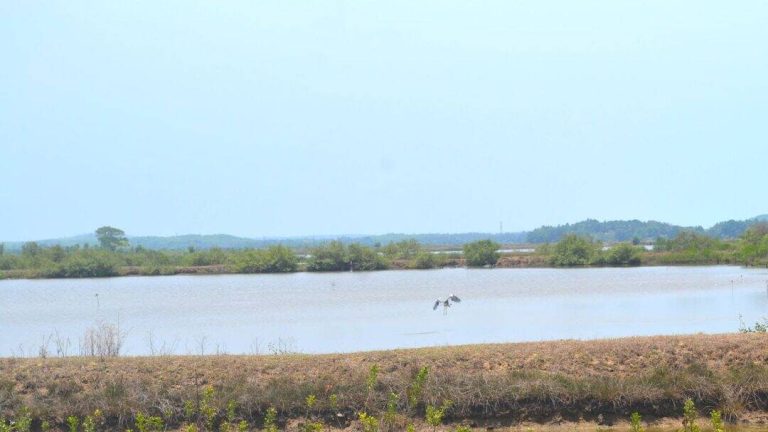
The Sentinel-2 satellite mapping system is a game-changer for monitoring India’s wetlands, which are crucial ecosystems that provide numerous benefits, including water filtration, flood control, and habitat for countless species. The system uses advanced satellite imagery to map and monitor the health of India’s wetlands, allowing scientists to track changes in plant life and identify areas that require conservation efforts. In a recent study, the researchers used Sentinel-2 to monitor 500 of India’s largest wetlands, and the results are alarming.
The study found that nearly 100 lakes, mostly in central and southern India, are experiencing a major decline in vital plant life. This decline is a warning sign that these ecosystems are under stress and require urgent conservation efforts. The researchers used Sentinel-2 to analyze the satellite data and identified the decline in plant life, which is a critical indicator of the health of these ecosystems. The study’s findings call for immediate climate action to protect India’s wetlands and the biodiversity they support.
The Sentinel-2 satellite mapping system is a powerful tool for monitoring India’s wetlands, and its applications extend beyond just identifying declines in plant life. The system can also be used to track changes in water quality, monitor the spread of invasive species, and identify areas that are vulnerable to climate change. By using Sentinel-2, scientists can gain a better understanding of the complex interactions within these ecosystems and develop effective conservation strategies to protect them.
The development of Sentinel-2 is a testament to the power of collaboration between scientists, researchers, and institutions. The team of researchers from ISRO, IIST, and Gujarat University worked together to develop the satellite mapping system, which is a significant achievement in the field of remote sensing and biodiversity conservation. The study’s findings have important implications for conservation efforts in India and highlight the need for urgent climate action to protect the country’s biodiversity.
The decline in plant life in India’s wetlands is a warning sign that these ecosystems are under stress, and it is essential to take immediate action to protect them. The Sentinel-2 satellite mapping system provides a powerful tool for monitoring these ecosystems and identifying areas that require conservation efforts. By using this technology, scientists can develop effective conservation strategies to protect India’s wetlands and the biodiversity they support.
In addition to the Sentinel-2 satellite mapping system, there are several other initiatives underway to protect India’s biodiversity. The Indian government has launched several conservation programs, including the National Mission for a Green India, which aims to increase the country’s forest cover and promote sustainable land use practices. The government has also established several protected areas, including national parks and wildlife sanctuaries, to provide a safe habitat for endangered species.
However, despite these efforts, India’s biodiversity continues to face numerous threats, including climate change, habitat destruction, and pollution. It is essential to address these threats through a combination of conservation efforts, sustainable land use practices, and climate action. The Sentinel-2 satellite mapping system is a critical tool in this effort, as it provides a powerful means of monitoring India’s wetlands and identifying areas that require conservation efforts.
In conclusion, the Sentinel-2 satellite mapping system is a powerful tool for protecting India’s biodiversity, particularly in the country’s wetlands. The system’s ability to identify submerged plants with 94% accuracy makes it an invaluable resource for scientists and conservationists. The study’s findings, which highlight the decline in plant life in nearly 100 lakes, are a warning sign that these ecosystems are under stress and require urgent conservation efforts. As India continues to face numerous threats to its biodiversity, the Sentinel-2 satellite mapping system will play a critical role in monitoring and protecting the country’s ecosystems.