How does Sentinel-2 protect India’s biodiversity?
India, a country known for its rich and diverse biodiversity, is home to a wide range of ecosystems, including wetlands, forests, and grasslands. These ecosystems support a vast array of plant and animal species, many of which are found nowhere else in the world. However, India’s biodiversity is facing numerous threats, including climate change, habitat destruction, and pollution. To combat these threats and protect India’s biodiversity, scientists at the Indian Space Research Organisation (ISRO), the Indian Institute of Space Technology (IIST), and Gujarat University have developed a new satellite mapping system, Sentinel-2.
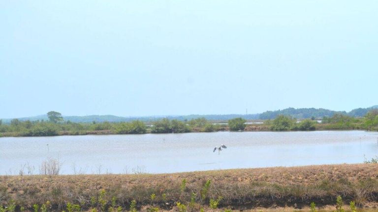
Sentinel-2 is a cutting-edge technology that uses satellite imagery to monitor and map India’s wetlands, which are some of the most critical ecosystems in the country. Wetlands provide a range of essential services, including water filtration, flood control, and habitat for countless plant and animal species. However, these ecosystems are facing numerous threats, including climate change, which is altering water levels, temperature, and precipitation patterns. As a result, many of India’s wetlands are experiencing a decline in plant life, which can have severe consequences for the entire ecosystem.
The Sentinel-2 system has been shown to be highly effective in identifying submerged plants, with an accuracy of 94%. This is a significant improvement over traditional methods of monitoring plant life, which can be time-consuming and labor-intensive. By using satellite imagery, scientists can quickly and easily monitor large areas of wetlands, identifying areas where plant life is declining and taking action to protect these ecosystems.
The study, which monitored 500 of India’s largest wetlands, found that nearly 100 lakes, mostly in central and southern India, are experiencing a major decline in vital plant life. This is a alarming trend, as plant life is essential for maintaining the health and biodiversity of these ecosystems. The decline in plant life can have severe consequences, including reduced water quality, decreased habitat for animal species, and increased greenhouse gas emissions.
The results of the study call for urgent climate actions to protect India’s wetlands and the plant life that they support. Climate change is a major driver of the decline in plant life, and reducing greenhouse gas emissions is essential for mitigating its impacts. Additionally, conservation efforts, such as restoring habitats and protecting wetlands from human impacts, are critical for maintaining the health and biodiversity of these ecosystems.
The Sentinel-2 system has the potential to play a critical role in these conservation efforts. By providing accurate and up-to-date information on the health of India’s wetlands, scientists and policymakers can take targeted actions to protect these ecosystems. For example, areas where plant life is declining can be prioritized for conservation efforts, and restoration activities can be targeted to areas where they are most needed.
In addition to its potential for conservation, the Sentinel-2 system also has the potential to support sustainable development in India. Wetlands provide a range of ecosystem services, including water filtration, flood control, and habitat for fish and other aquatic species. By protecting these ecosystems, India can ensure the long-term sustainability of its natural resources and maintain the health and well-being of its citizens.
In conclusion, the Sentinel-2 system is a powerful tool for protecting India’s biodiversity. By using satellite imagery to monitor and map India’s wetlands, scientists can identify areas where plant life is declining and take action to protect these ecosystems. The results of the study, which monitored 500 of India’s largest wetlands, call for urgent climate actions to protect these critical ecosystems. By reducing greenhouse gas emissions and taking conservation actions, India can maintain the health and biodiversity of its wetlands, ensuring the long-term sustainability of its natural resources and the well-being of its citizens.
The development of the Sentinel-2 system is a testament to the power of science and technology to drive positive change. By harnessing the latest advancements in satellite imagery and mapping, scientists can provide critical information for conservation efforts and support sustainable development. As India continues to grow and develop, it is essential that the country prioritizes the protection of its biodiversity, including its critical wetland ecosystems.
The use of satellite imagery to monitor and map India’s wetlands is just one example of the many ways in which science and technology can be used to protect the environment. By leveraging these tools, India can ensure the long-term sustainability of its natural resources and maintain the health and well-being of its citizens. The Sentinel-2 system is a critical step in this direction, and its potential to support conservation efforts and sustainable development is vast.
In the coming years, it will be essential to continue to develop and refine the Sentinel-2 system, ensuring that it remains a powerful tool for protecting India’s biodiversity. This will require ongoing investment in science and technology, as well as a commitment to using these tools to drive positive change. By working together, scientists, policymakers, and conservationists can ensure the long-term health and sustainability of India’s critical ecosystems, including its wetlands.
News Source: https://researchmatters.in/news/satellite-monitoring-reveals-declining-plant-life-hundreds-indian-wetlands